Puna Weather
Tuesday 21st July 2026
Today through Friday light to moderate easterly trade winds with widely scattered showers, mostly at night.
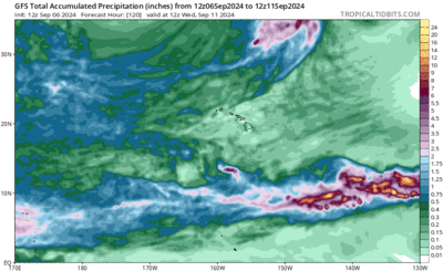
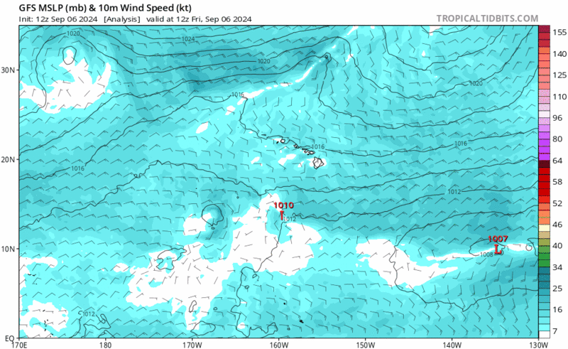
A beign weather pattern for us over the next week or so. High pressure to our north continues to drive weaker than normal trade winds. The ocean surrounding our island is warmer than normal so the air is warmer and more humid.
In the eastern Pacific it's more active with models showing several storms forming over the next couple of weeks. A positive pulse in the MJO is currently over that area and transitioning towards the Indian Ocean over the next couple of weeks. The MJO overhead is likely to be contributing to the active forecast. With El Nino firmly in place we see warm waters from the tropics to our island chain. Surrounding our island waters are above 26C, somewhat of a lower limit for cyclones to maintain strength. We'll be on our toes later this season for sure, but in the near term mid-level dry and stable air to our east presents a hostile environment for any activity heading our way from Mexico.